


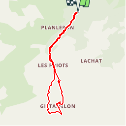

8.2 km | 13.3 km-effort


User


FREE GPS app for hiking
 SityTrail
IGN / Geographical institutes
SityTrail World
The world is yours!
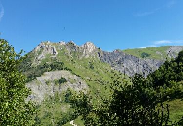
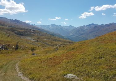
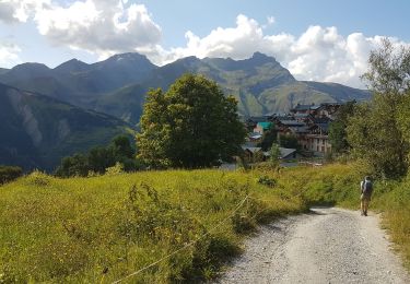
Trail Walking of 7.3 km to be discovered at Auvergne-Rhône-Alpes, Savoy, Les Belleville. This trail is proposed by gilsep.
Laisser la voiture au parking de la Fenêtre (cote 1454). Variante pour le retour par la jolie route qui descend du refuge vers le parking.

Walking

Walking

Walking
Walking

Walking
Walking
Walking
Walking

Snowshoes